Julia Fischer
 Name: Julia Fischer
Hometown: Langhorne, PA
Anticipated graduation: May 2026
Major(s): Mathematics, B.S.E.
Internships/Research/Projects:
- Honors College Thesis
-
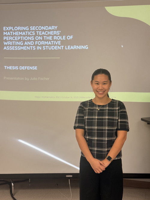
As a part of the Millersville Honors College experience, I had the privilege of completing my thesis, "Exploring Secondary Mathematics Teachers' Perceptions on the Role of Writing and Formative Assessments in Student Learning." Working with my thesis advisor, Dr. Janet White, as well as my committee members, Dr. Moss and Dr. Witmer, was a meaningful experience that was shaped by hard work and a passion for the topic. Throughout this time, I gained invaluable insight from one-on-one interviews with current secondary mathematics teachers where they shared their experiences with writing and formative assessments in their classrooms.
-
- Preservice Teacher Experience
- During the fall semester of my senior year, I completed 100+ hours of field placement experience in an urban middle school math classroom and 100+ hours in a suburban high school math classroom. Those hours were filled with growth, learning, and appreciation for wisdom imparted from my wonderful co-op teachers.
- Student Teacher Experience
- Currently I am a student teacher in a suburban high school math classroom where I am able to step into a new role with the confidence that my previous experiences have prepared me well for this next step in my teaching journey. I am proud to see how far I have come and I am eager to see what awaits me during this next step in my teaching journey.
Throughout my secondary education experience, I leaned more towards the quieter side and often lacked confidence in my abilities as a student. Coming to Millersville changed that, and I found myself truly able to blossom thanks to the community I found here.
I would not be the student I have become without the support from professors such as Dr. Han and Dr. Heitmann. I am also grateful for Dr. Robinson who has created the welcoming, energetic, and genuine community found within many of the math department organizations and activities I was fortunate to be a part of. I am especially grateful for Dr. White, whose mentorship and guidance throughout my thesis meant more to me than I can put into words. I also want to thank Dr. Moss, who supported me throughout my preservice teaching experiences and continues to support me in my student teaching.
Additionally, I am eternally grateful for the Honors College for introducing me to some of my closest friends here at Millersville. I can wholeheartedly say that I would not be the person I am now without the love and support from my amazing friends here. Last and most certainly not least, I would not be where I am today without the love and encouragement of my family.
Highlights (from courses/internship/research):
I would say some of my biggest highlights at Millersville come from the strong communities I formed within both the Mathematics Department and the Honors College. Communities I will forever cherish.
Through the Mathematics Department, I found myself involved in more activities than I ever expected. I tutored in the Mathematics Assistance Center and held positions on both the Math Club and MEMU (Math Educators at Millersville University) boards. Some of my favorite math-related memories include Wicke @ Nite (a night in Wickersham filled with games, challenges, and even karaoke), the semesterly Math Fair held at a local elementary school, and introducing the "mathemagician" Dr. Arthur Benjamin during the 39th annual Brossman Foundation and Ronald E. Frisbie, Sr. Science Lectureship Program at Millersville University.
Through the Honors College, I had the once-in-a-lifetime opportunity to go abroad with some of my closest friends. We went on a two-week study abroad trip titled Transcending Borders where Dr. Wolfgang guided us through four countries in Europe as we explored diplomacy, sustainability, and transportation. Experiencing Europe was truly unforgettable, and it's an opportunity I highly recommend to anyone considering the next trip.
I also had the honor of joining the Cygnus Society during the spring of my junior year. My time in Cygnus gave me training in both etiquette and professionalism, which I continue to carry into every event where I have the privilege of representing Millersville.
The Cygnus Society truly helped me to develop into my best professional self where I gained the confidence and skills to succeed in any room I walk into. As ambassadors of the Office of the President, Cygnus members participate in many university functions, many of which I never imagined being part of. Through these events, I've had the privilege of meeting people whose generosity, dedication, and overall love for Millersville have shaped the university I get to experience every day.
Takeaway (from courses/internship/research):
A major takeaway from my courses, internship, and research is the importance of building relationships and creating a community to grow with. Among math majors, it's often said that forming a community is what ensures your success. I wholeheartedly agree with that sentiment and I truly can't imagine what my experience at Millersville would have looked like without the support systems I found here. Whether it be working on my thesis, going abroad, or stepping into a new classroom, I always knew I had my community behind me and mentors I could trust to guide me along my journey.
Advice (for incoming freshman in your shoes):
Push yourself to take risks and get comfortable with being uncomfortable. Join the club, talk to the person next to you in class, go to office hours, and say yes to the opportunities that come your way. Many of the experiences I had the privilege of being part of began with me feeling unsure of whether I'd even be accepted or successful. But I took the risk, no matter how small, and I grew from each one.
You'll face challenges along the way, it's inevitable. Trust that you can do anything you set your mind to and ensure that you treat each moment as a chance to learn and become better.
Most of all, four years goes by fast. So enjoy every moment.
Aspirations (upon graduation):
After graduation, I hope to be teaching mathematics in a middle or high school setting. I would love to teach geometry or work as a middle school math teacher, but wherever life takes me, I know I would be incredibly lucky to find myself in any classroom where I can create an inclusive and nurturing environment - one that allows my students to grow and develop into their best selves.
Scholarships awarded while attending Millersville University
- MU Presidential Scholarship
- Isaac F. Seiverling Award
- APSCUF Scholarship
- Edna Meyers Scholarship
- Secondary Education Mathematics Upperclassmen Scholarship
- Class of 1866 Award